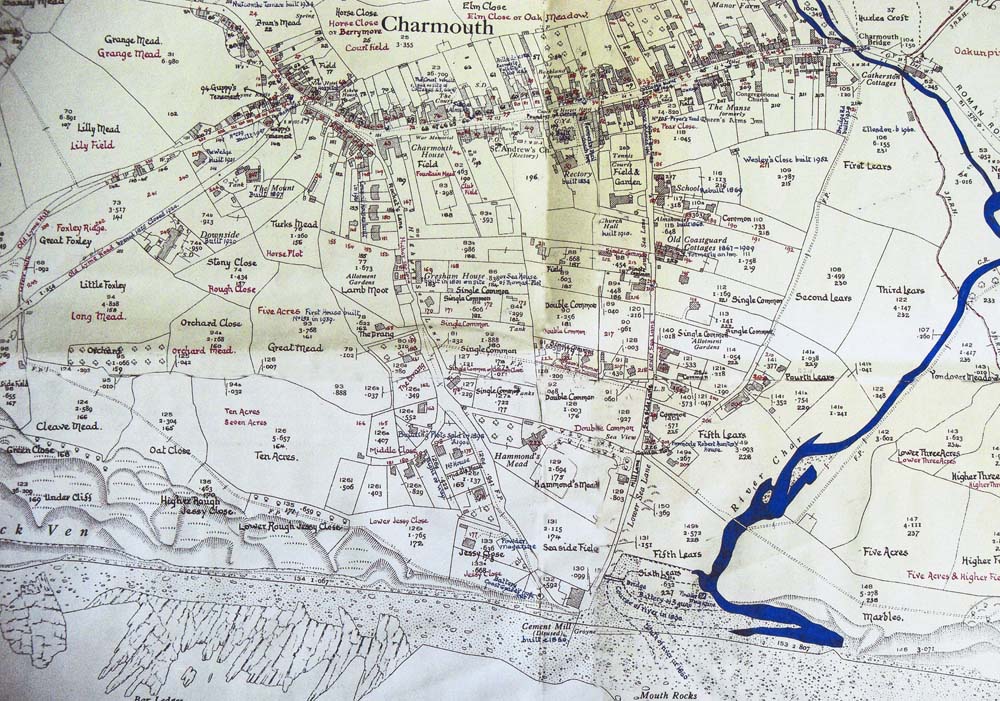
1926 Map for Charmouth
|
THE WEB FRESHFORD SITE |
Click on Map for larger version or on Charmouth Home to return back.

 |
1926 Map for Charmouth |
|
|
| The Map below is extremely useful as it was drawn up by the famous Charmouth Historian, Reginald Pavey, using the1926 Ordnance Survey Map as a basis for updating the earler 1841 Tithe Map for Charmouth. It was created c. 1960 and the names of the some of the properties may have changed since then. If you click on this map you will be linked to the larger map, which may take a little longer to load and with that is a key to the numbers drawn on to the map. | |||
Click on Map for larger version or on Charmouth Home to return back. |
|||
 |
|||