
Maps of Dorset
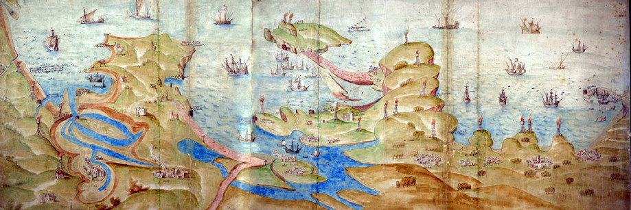
South West coast of England - 1539
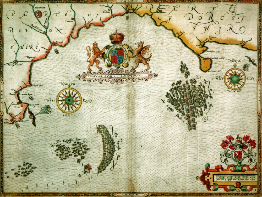
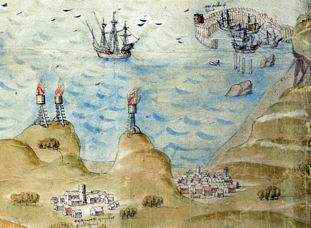
A contemporary Map of 1588 showing the English and Spanish Fleet in Lyme Bay.
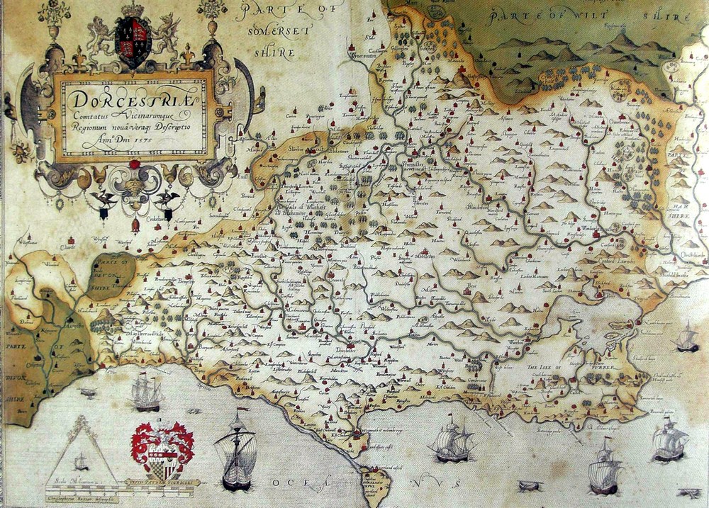
Christopher Saxton`s Map of Dorset -1579
William Kip`s Map of Dorset - 1607
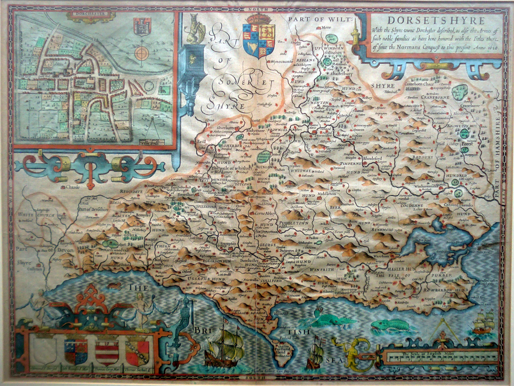
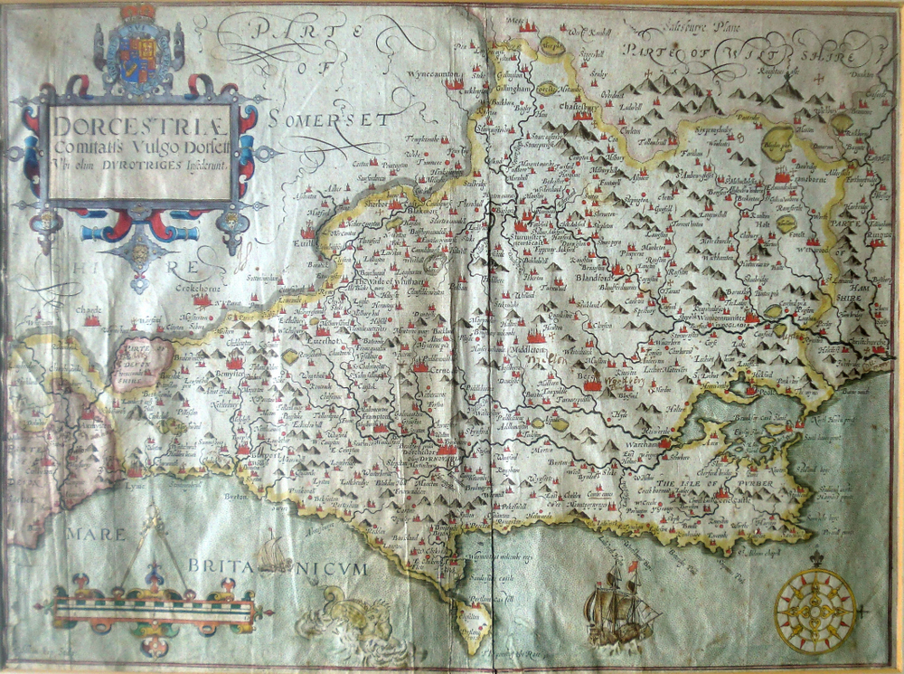
John Speed`s Map of Dorset -1610
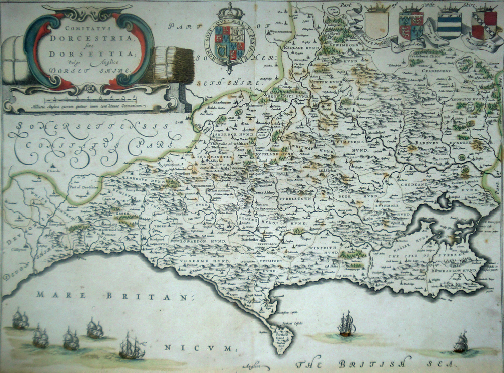
Joannes Blaeu`s Map of Dorset -1645
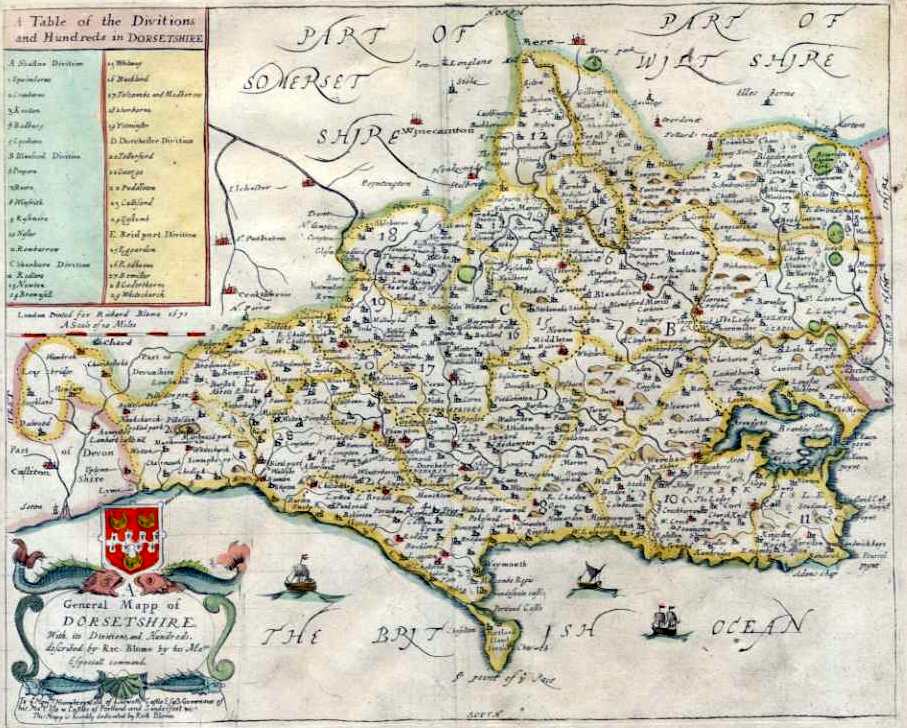
Richard Blome`s Map of Dorset - 1673
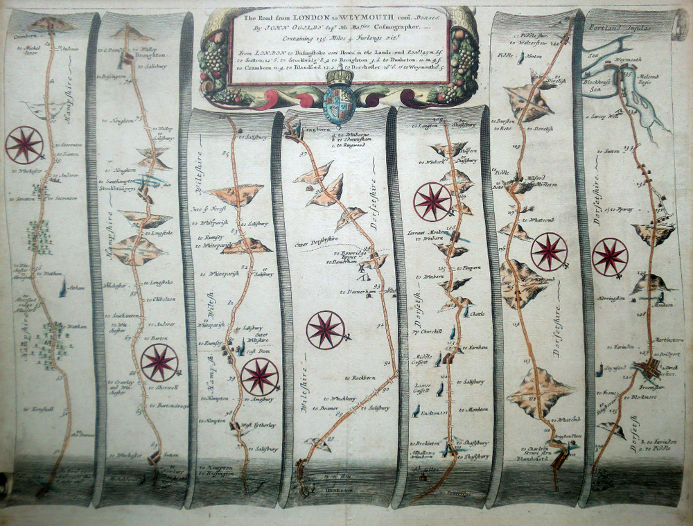
John Ogilbys Road Map of Dorset (1) - 1675
.jpg)
John Ogilbys Road Map of Dorset (2) - 1675
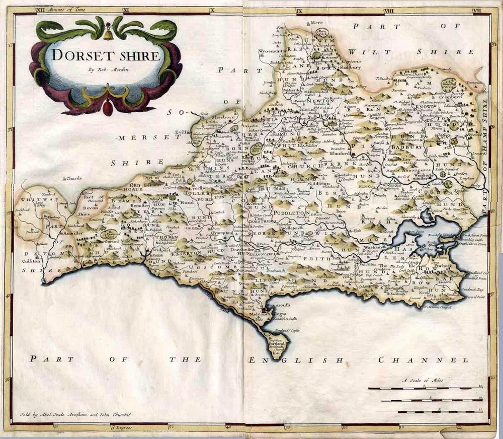
Robert Morden`s Map of Dorset - 1695
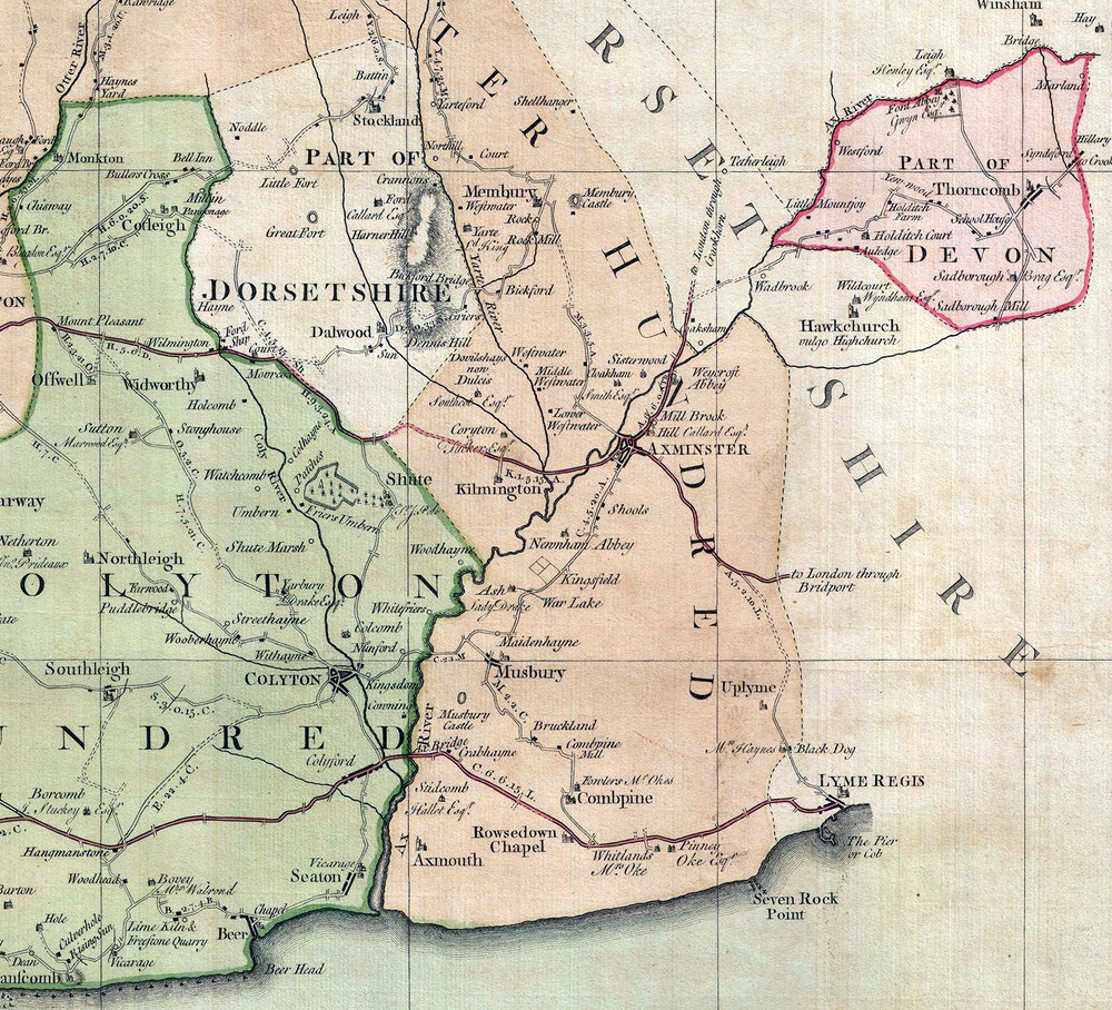
A Section of the Donne Map of Devon -1765
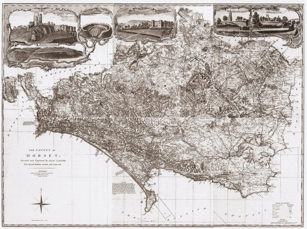
Isaac Taylor Map of Dorset - small scale - 1764
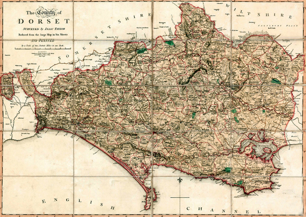
IsaacTaylor Map of Dorset small scale - 1796
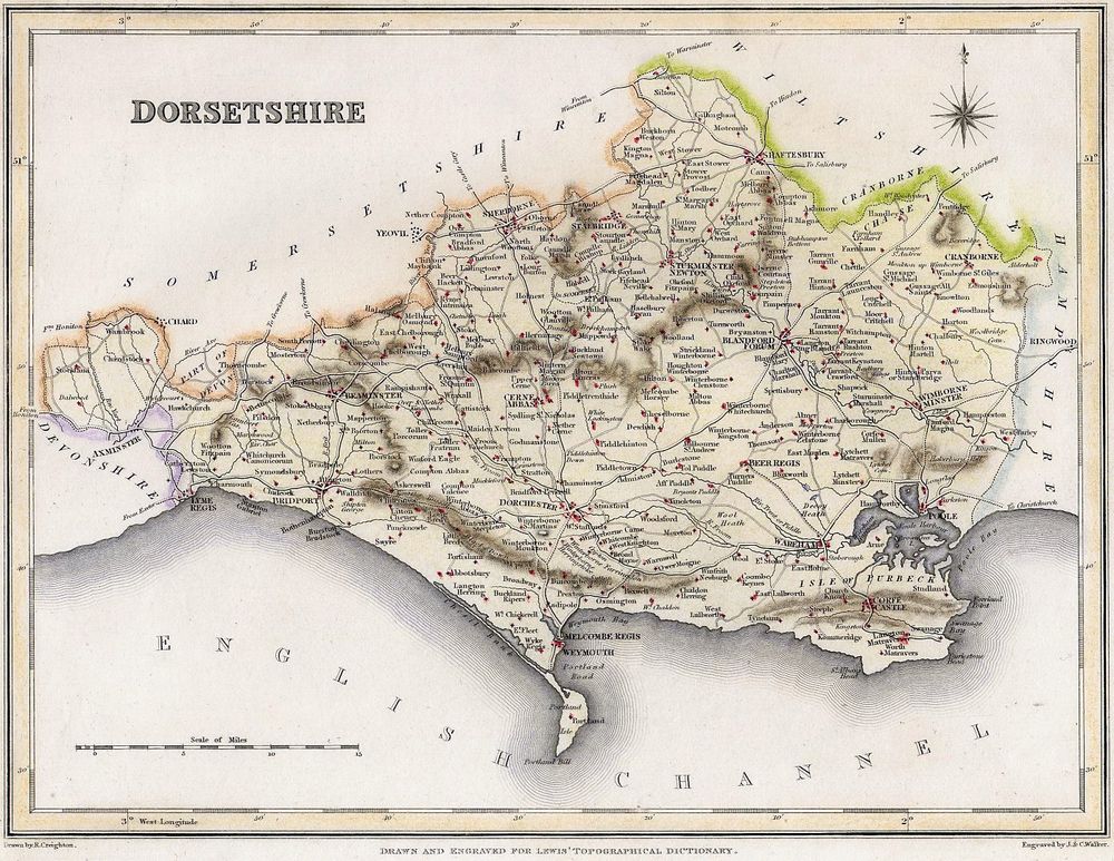
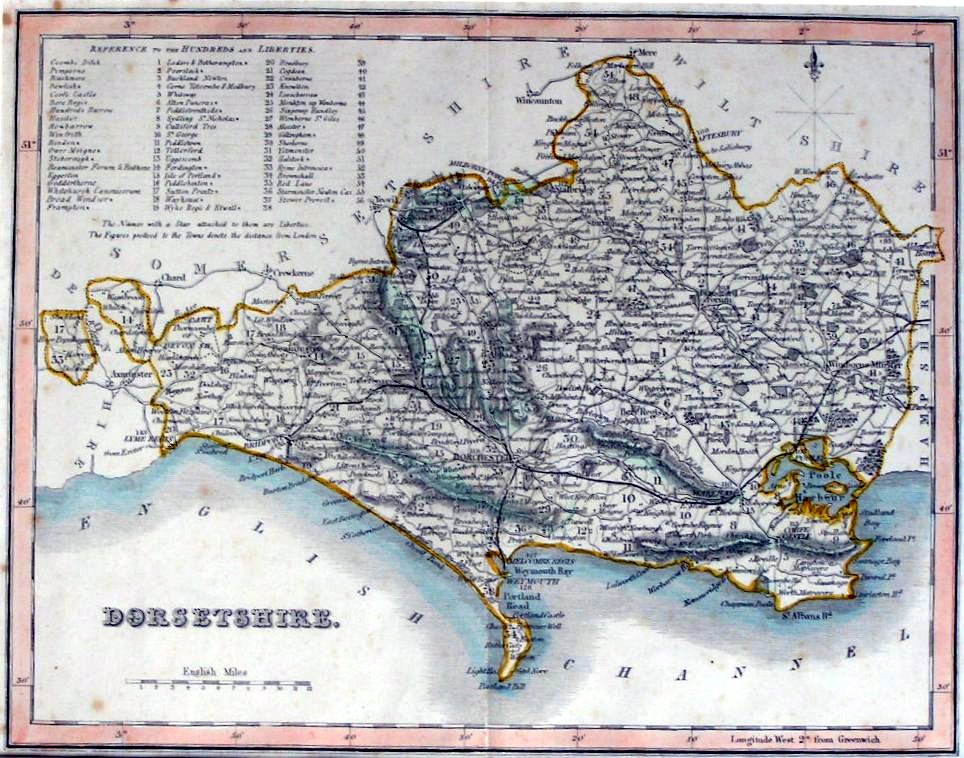
R. Creighton / J. and C. Walker Map of Dorset -1831
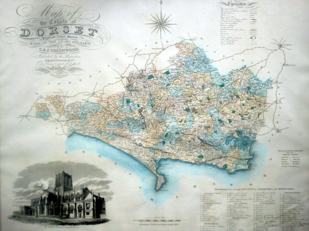
C & J.Greenwood Map of Dorset 1829 - small scale
(23 x 27").
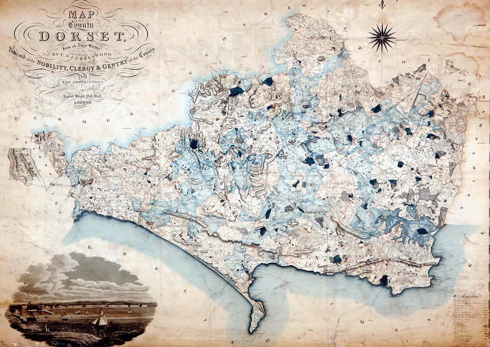
C & J.Greenwood Map of Dorset 1826- large scale
(62.25 by 46 inches).
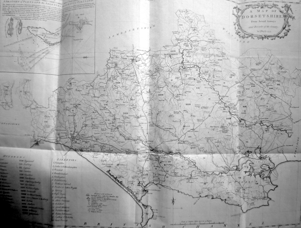
Bayly`s Map of Dorset from Hutchin`s History of Dorset - 1773
.jpg)
.jpg)
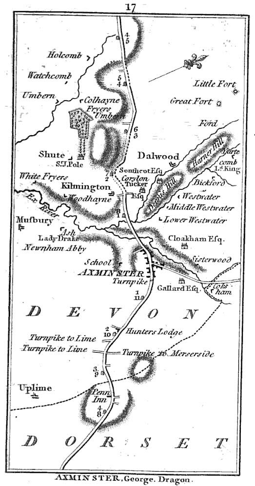
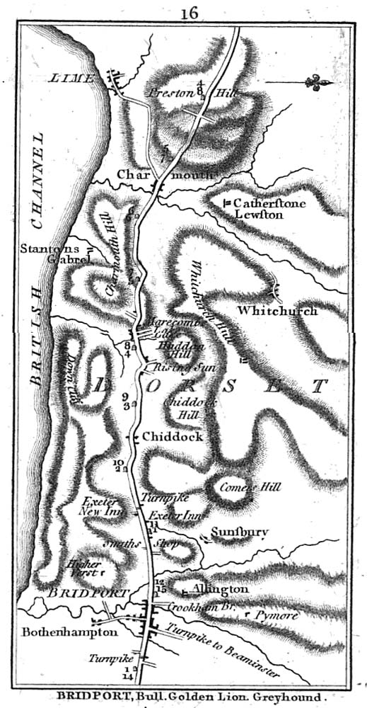
Owen and Bowen`s Map of Road from Exeter to Bridport - 1720
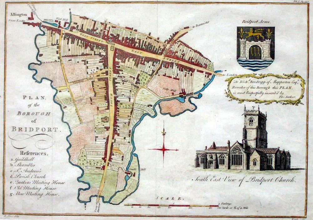
Bayly`s Map of Bridport in Dorset from Hutchin`s History of Dorset - 1773
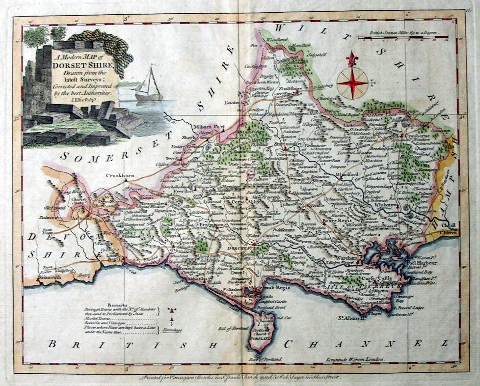
J.Eliss`s Map of Dorset - 1765
Cary's actual survey, of the great post roads between London and Falmouth by Aaron Arrowsmith - 1782
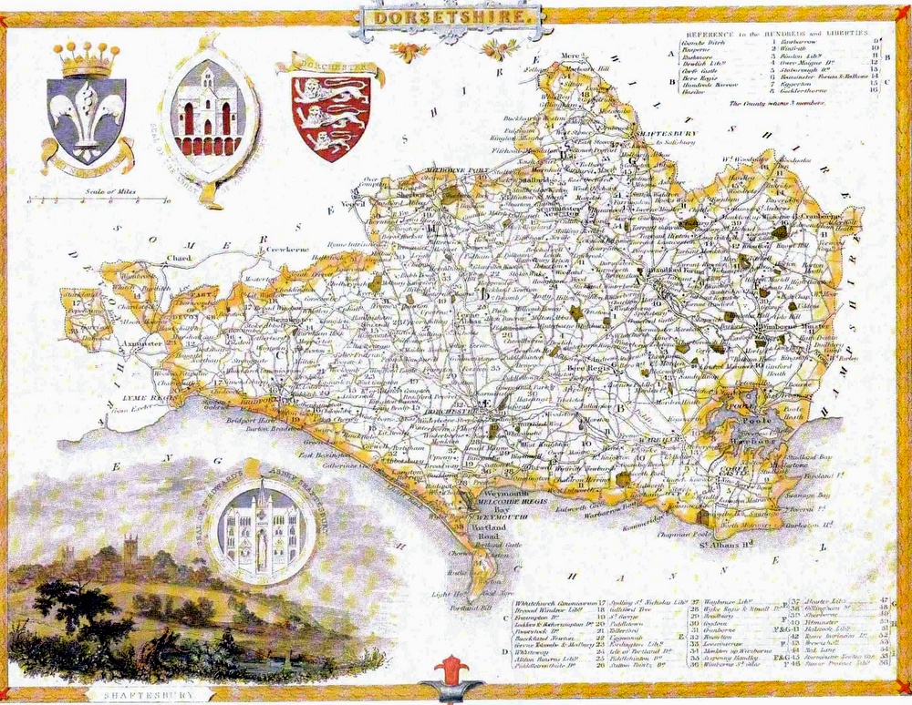
Thomas Moule`s Map of Dorset - 1830
Fullarton`s Map of Dorset - 1840
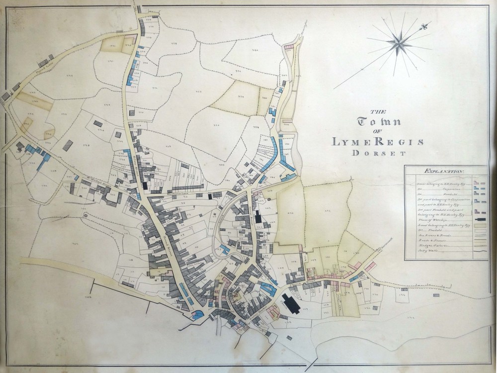
Map of Lyme Regis c.1826 (click for larger version)
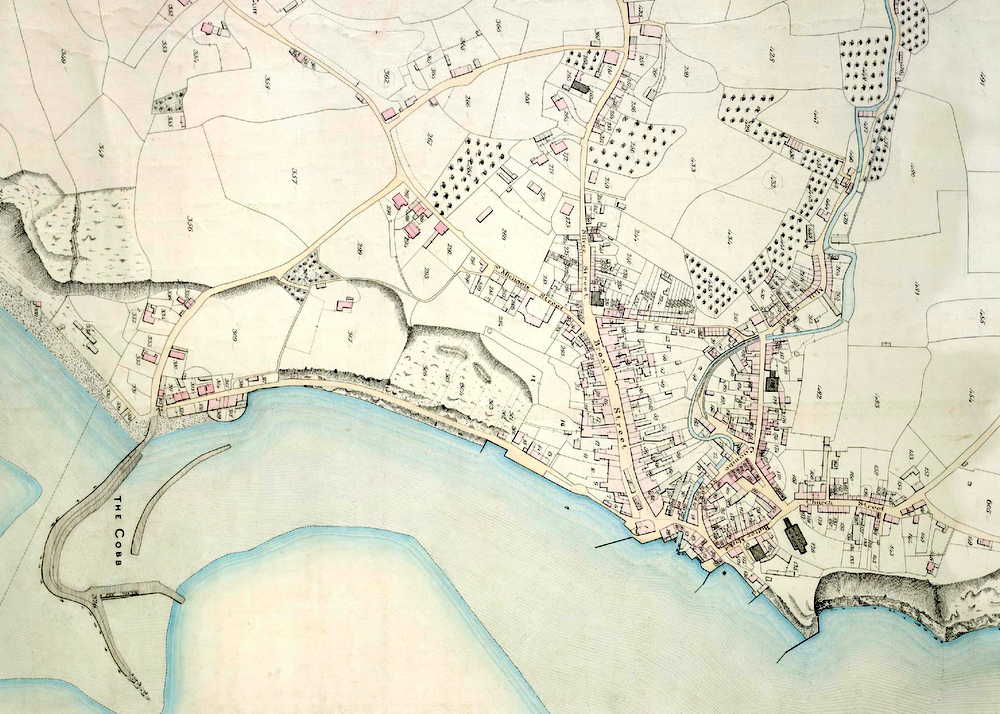
Tithe Map of Lyme Regis c.1841 (click for larger version)
1539 Map showing Charmouth and Lyme Regis
.jpg)
1764 Map showing Charmouth and Lyme Regis